Heavy flooding on the Havana boardwalk
The Cuban Institute of Meteorology (INSMET) reports that a strong and extensive extra-tropical low over South Carolina, United States, covers the entire Cuban territory with its wide circulation, imposing strong winds from the Northwest region between 25 to 40 kilometers on the western region. per hour, with gusts of over 60 kilometers per hour and strong swells on the north western coast.
Speaking to the Cuban TV Information System, Lieutenant Colonel Mario García, Chief of the Civil Defense Organ of Havana, described the situation in the capital's Vedado: "We have flooded some 13 basements and 40 self-evacuated families. Until now No significant damage or loss of any kind has been reported."
For his part, Jayr Morales, first secretary of the Communist Party of Cuba in the Plaza de la Revolución municipality, commented that the penetration was stronger than expected, since "there had been talk of light or moderate and it has reached a higher level." However, he assured that the necessary measures were adopted to ensure the lives of people.
The Red Cross, the Fire Department, Public Health and Civil Defense assisted the affected population. Major Fabián Rodríguez, chief of Rescue and Salvage of the Fire Department, specified in a report broadcast during the Star Newscast that he has all the strength to continue responding to situations that arise.
At noon, INSMET warned that "the persistence of the winds will produce moderate coastal flooding in low-lying areas of the northwestern coast, including the Havana seawall. This meteorological situation will begin to gradually decrease from Tuesday morning, when the winds turn north and lower your intensity.
The well-known Cuban meteorologist, Dr. José Rubiera, explained in the televised part around 8pm, that the floods will decrease and are expected to stop in the next few days.
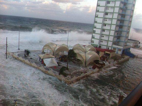
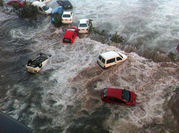
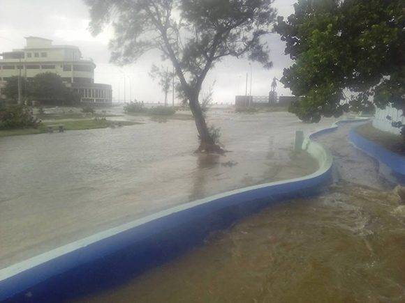
We leave you with these impressive photographs and video images that illustrate part of the influence of the extra tropical low in areas surrounding the Havana seawall.
Flooding on the Havana boardwalk. Photo: Luis Miguel Cabrera/Facebook.
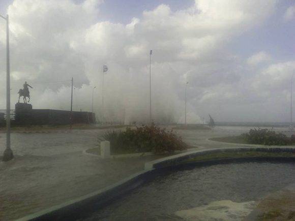
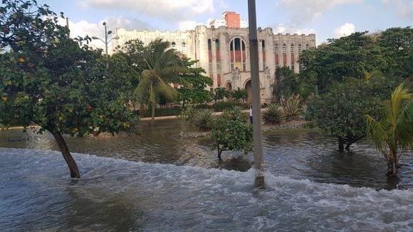
Flooding at the monument to Calixto García, located on Malecón and G. Photo: Luis López González/ Facebook
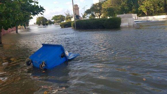
Sea penetrations on G Street, near the boardwalk. Photo: Luis López González/Facebook.
This is what G Street looked like, near the corner of Línea in Vedado on Wednesday afternoon. Photo: Alejandro Cruz/Facebook.
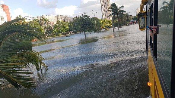
Flooding on Calle G or Avenida de los Presidentes. Photo: Alejandro Cruz/Facebook.
The area around the corner of Línea and G was also affected by the strong penetration of the sea. Photo: Alejandro Cruz/Facebook.
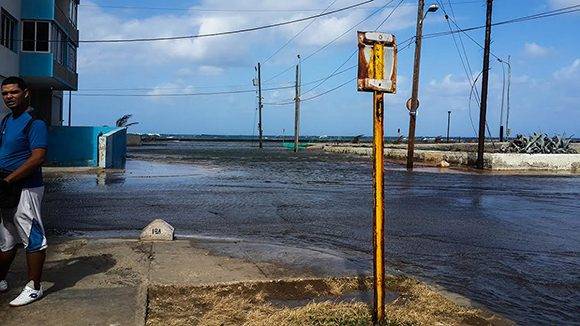
The water penetrates several streets after the boardwalk. Photo: Cinthya García Casañas/ Cubadebate.
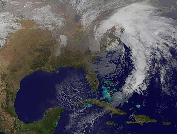
Image showing the strong and extensive extra-tropical low over South Carolina affecting the northwestern coast of Cuba. Photo: NOAA/ INSMET.
Cuban TV report on the floods:
(With information from the Institute of Meteorology/ Information System)
Taken from Cubadebate